


22 km
Itinerary
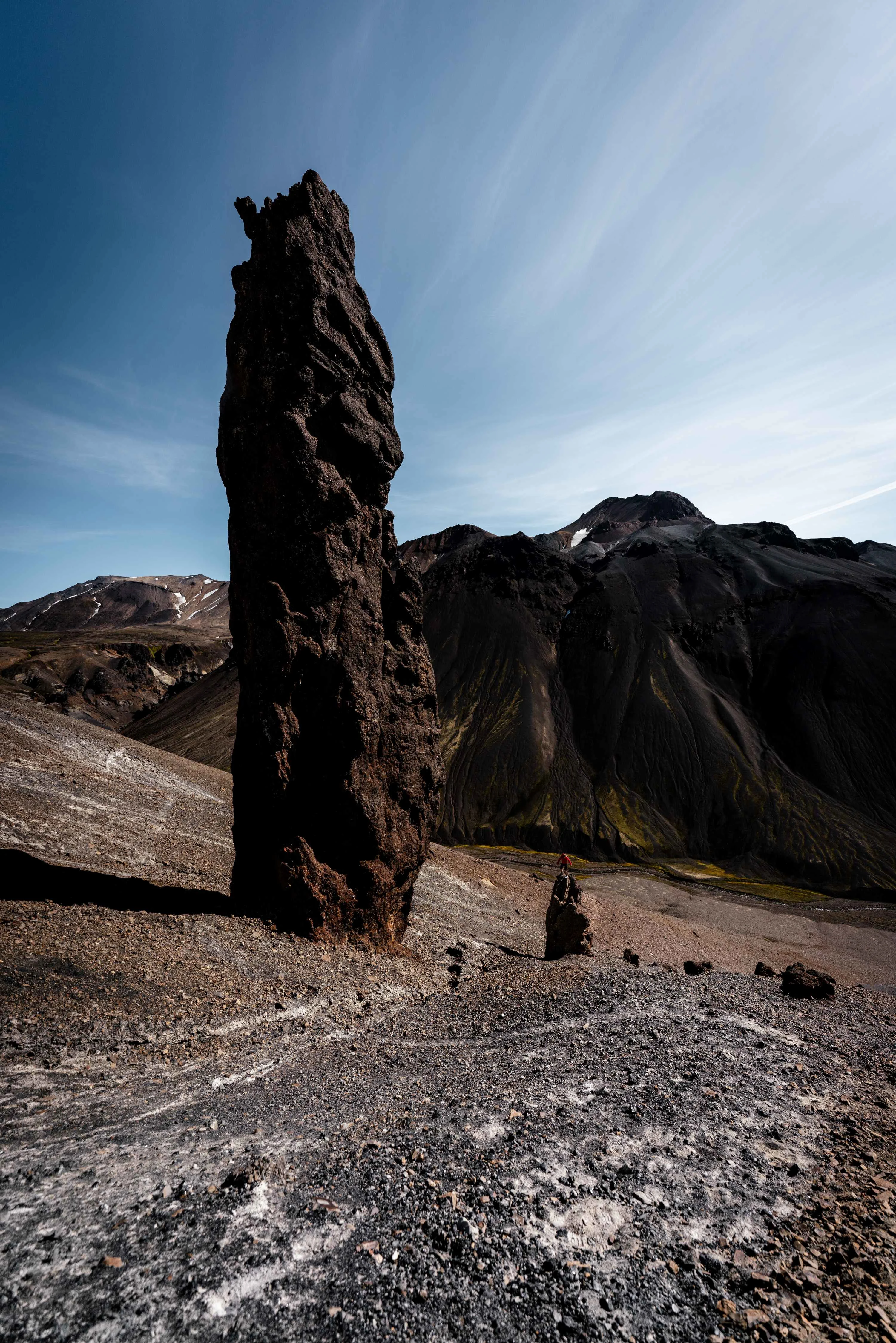
Starting from the hotel, runners head directly south up a steep path that winds through Ásgarðshryggur, situated between two canyons. Then, the route continues towards Hveradalahnúkur and the roaring Snorrahver hot spring, and down into the magnificent Hveradalir, where the first drink station of the route is located, after a 5 km run. From there, the path leads up and over Kerlingarskyggni, from where the views are incomparable. Carefully, the route then descends into Hverabotn, nestled between the mountains Mænir, Ögmundur, and Höttur. This is followed by a descent into a deep canyon and then up again to Kerling itself, a 25-meter high rock pillar on the side of Kerlingartindur. A short distance from there, or after a 14 km run, is the route's second drink station. From there, the run continues on the east side of Skeljafell, over Tindabikkja and the foremost Ásgarðsá river, up a rocky hill, and back to Ásgarðshryggur and to the finish line below the hotel.
At the drink station in Hveradalir you can find water, energy powder, bananas, pretzels, and chocolate. At the drink station by Kerling, only water and energy powder are available.
Map